
- Duration26 days
- Max. altitudeCholatse summit, 6,423 m (21,073 ft)
- GradeVery challenging and technical
- Start / endKathmandu to Kathmandu
- Group size
- Best seasonSpring (March–May) and autumn (September–November)
- AccommodationHotel in Kathmandu, teahouses/lodges on the trek and tented camps during the climb
- MealsTeahouse/lodge meals on the trek and expedition meals during the climb
- ActivityPeak climbing (technical mountaineering)
- TransportDomestic flights to and from Lukla, airport and road transfers
Overview
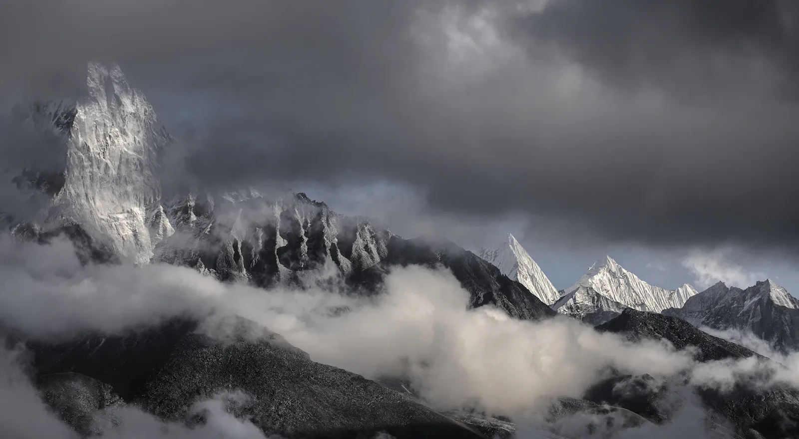
Cholatse (6,423 m) is a Himalayan peak in Nepal's Khumbu region. It lies between the Khumbu and Gokyo valleys and is connected to Taboche Peak by a long ridge.
Cholatse is a technical mountaineering objective. Its Southwest Ridge involves deep snow and ice, with exposed sections that call for climbing skills and rope techniques. This climb suits climbers with previous mountaineering experience, not first-timers.
The journey combines a high-altitude trek through the Khumbu with a difficult climbing objective. It takes you through beautiful Sherpa settlements such as Namche Bazaar before heading up the higher valleys to Dzongla and Cholatse Base Camp.
Cho La Pass sits at about 5,420 m, and from the pass the route continues toward the Cholatse climbing area. Other itineraries approach through the Khumbu and Gokyo valleys and use different acclimatization strategies.
Once you reach Base Camp, the journey changes: before moving higher on the mountain, climbers prepare their equipment and review their technical skills.
The Southwest Ridge, the established route, was first climbed in 1982.
A successful climb requires more than physical fitness. Climbers should know their basic equipment, such as crampons, ice axes and fixed ropes, and be comfortable on rough terrain, while the expedition team continuously assesses the weather, snow and ice conditions, route conditions and the climbers' condition.
Cholatse is an outstanding technical climb, where reaching the summit is only one part of the objective. Safe decision-making and a controlled descent matter just as much.
Cholatse Climbing Route
The normal route on Cholatse is the Southwest Ridge. The approach to the mountain varies through the Khumbu and Gokyo valleys, depending on the acclimatization strategy. A commonly used approach is:
Kathmandu → Lukla → Phakding → Namche Bazaar → Phortse/Pheriche → Dzongla → Cho La → Cholatse Base Camp → Southwest Ridge → Cholatse Summit
Some itineraries instead approach through Gokyo → Dragnag → Cho La → Dzongla → Cholatse Base Camp. The final approach depends on current route and weather conditions.
Cholatse Southwest Ridge
The Southwest Ridge is the standard route on Cholatse. The lower section includes steep snow and ice before the route gains altitude and moves into mixed terrain.
Fixed ropes may be needed on some sections. Higher up, the ridge becomes narrower, so climbers need careful movement and proper rope discipline.
Exact conditions depend on snowfall, temperature, wind and other weather factors, so the climbing team makes the final decisions based on current conditions rather than a standard route description.


Highlights
- Climb Cholatse at 6,423 m
- Take on a highly technical climb
- Trek into the 6,000 m range of the Khumbu region
- Experience traditional Sherpa villages and Himalayan culture
- Follow mountain trails through the Everest region
- Cross the dramatic Cho La Pass, depending on the final itinerary
- Explore the quieter area around Dzongla and Cholatse
- Climb the Southwest Ridge of Cholatse
- Gain experience on snow, ice and mixed mountain terrain
- Tackle exposed ridges and steep climbing sections
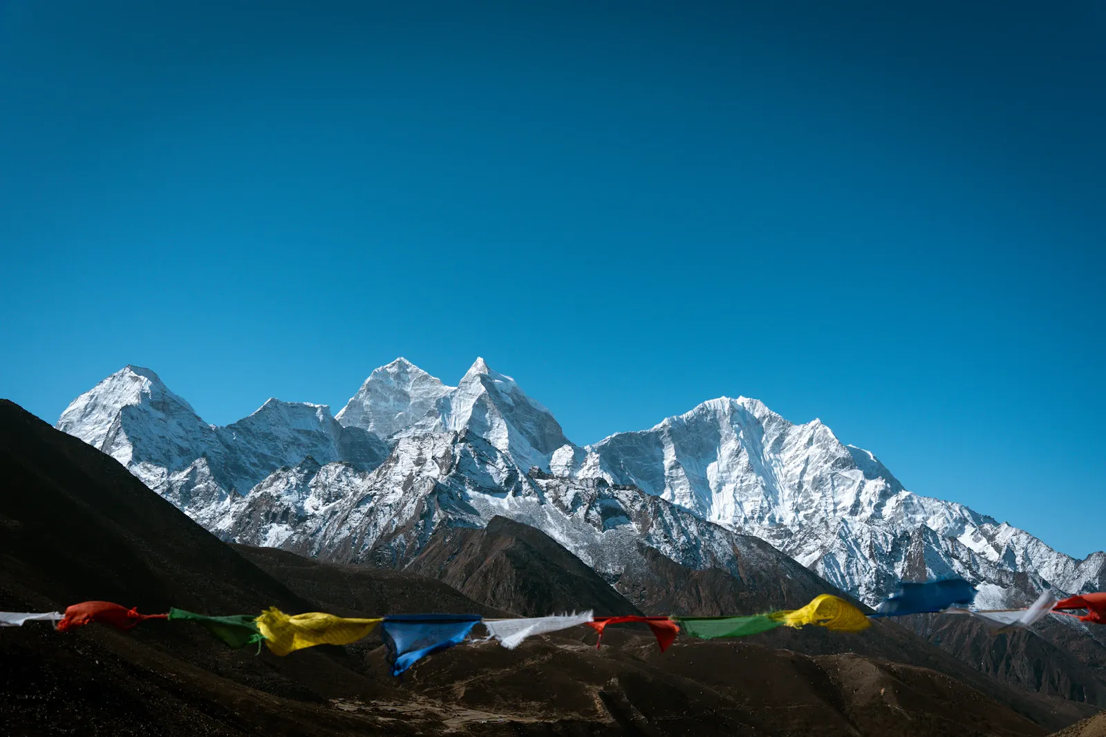
- Enjoy views of Everest, Lhotse, Nuptse, Ama Dablam, Taboche, Pumori and the surrounding Himalayan peaks when the weather allows
- Experience high-altitude camping at Base Camp and the higher camps
- Take on a demanding Himalayan objective that requires preparation and teamwork
Altitude profile
Top: Cholatse summit, 6,423 m (21,073 ft)Hover or tap a day for detailsScroll sideways to see every day
Itinerary at a glance
- Day 1Arrival in Kathmandu
- Day 2Preparation and Equipment Check in Kathmandu
- Day 3Fly to Lukla and Trek to Phakding
- Day 4Phakding to Namche Bazaar
- Day 5Acclimatization Day in Namche Bazaar
- Day 6Namche Bazaar to Phortse
- Day 7Phortse to Pheriche
- Day 8Acclimatization and Rest Day in Pheriche
- Day 9Pheriche to Lobuche
- Day 10Acclimatization and Preparation Day
- Day 11Trek to Dzongla
- Day 12Cross Cho La Pass and Trek to Cholatse Base Camp
- Day 13Rest, Acclimatization and Technical Preparation at Base Camp
- Day 14Acclimatization Rotation / Carry Toward Camp I
- Day 15Rest and Recovery at Base Camp
- Day 16Base Camp to Camp I
- Day 17Camp I to High Camp / Camp II
- Day 18Summit Attempt – Cholatse 6,423 m
- Day 19Weather / Contingency Day
- Day 20Weather / Contingency Day
- Day 21Descend from Cholatse Base Camp to Pangboche
- Day 22Pangboche to Namche Bazaar
- Day 23Namche Bazaar to Lukla
- Day 24Fly Lukla to Kathmandu
- Day 25Contingency / Leisure Day in Kathmandu
- Day 26Final Departure
Day-by-day itinerary
Altitudes are the highest point reached that day. Walking times are typical and exclude breaks; your guide adjusts the pace to the group.
When you arrive in Kathmandu (approx. 1,400 m), you are transferred to your hotel. Rest for a while, then meet your trekking team and receive the trek briefing from your guide.
Today is for preparation and reviewing the equipment needed for the journey. Your climbing guide explains the climbing and trekking route, safety, acclimatization and the equipment needed for Cholatse.
You can also buy any equipment you still need and arrange to store anything you want to leave behind. If time allows, explore Kathmandu before heading to the Khumbu region.
Altitude: Lukla approx. 2,860 m, Phakding approx. 2,610 m
The journey starts with a flight to Lukla, the main gateway to the Khumbu region. After landing, you trek through the Dudh Koshi Valley to Phakding.
The walk is short, giving your body time to adapt to the Himalayan environment. You pass small villages, cross suspension bridges and walk through forest sections as you take in the Khumbu landscape.
The route follows the Dudh Koshi River toward Namche Bazaar (approx. 3,440 m). Crossing suspension bridges, you pass pine and rhododendron forests before the steep climb toward Namche.
After entering Sagarmatha National Park and crossing the final suspension bridges, the trail brings you to the Sherpa trading town of Namche Bazaar, an important stop before continuing into the higher Khumbu.
Today is an important acclimatization day. You spend some time around Namche and take a short hike to a higher viewpoint, allowing your body to adapt to the increasing altitude.
You can also use the day to rest, hydrate and prepare for the journey ahead.
The trail climbs steeply into the Khumbu. Depending on the final route, it continues through the Mong La area before descending to Phortse (approx. 3,950 m).
Phortse is a traditional Sherpa community surrounded by scenic mountain views, and the terrain becomes increasingly alpine as you move higher.
Today you continue toward Pheriche (approx. 4,270 m). As you climb higher, the landscape becomes more rugged, with less vegetation and wider mountain views, and the peaks appear closer as you approach the high-altitude valleys.
Pheriche is a key stop for rest and acclimatization before heading higher into the mountains.
Today is set aside for rest and acclimatization. Taking things slowly helps your body adjust before the higher sections of the Cholatse climb.
You can enjoy a short, easy hike around Pheriche to help your body adjust to the altitude, then use the rest of the day to rest, hydrate, check your gear and prepare for the next stage.
The trail continues toward the higher Khumbu. The landscape becomes more barren, and the surrounding peaks look closer and clearer.
Lobuche (approx. 4,910 m) is a good place to rest and adjust to the altitude before heading toward Cholatse.
Today is another step toward the higher part of the journey, dedicated to getting used to the altitude and preparing for the climb.
The climbing team checks all the equipment, makes sure everyone is physically ready and prepares for the route toward Dzongla and Cholatse.
The trail leaves the Everest Base Camp route and heads toward Dzongla (approx. 4,830 m). The landscape becomes quieter and more remote.
Dzongla lies beneath towering peaks and is an important stop for climbers preparing to approach Cholatse. After arriving, you can rest and prepare for the high-altitude crossing ahead.
Altitude: Cho La Pass approx. 5,420 m, Base Camp approx. 5,000 m
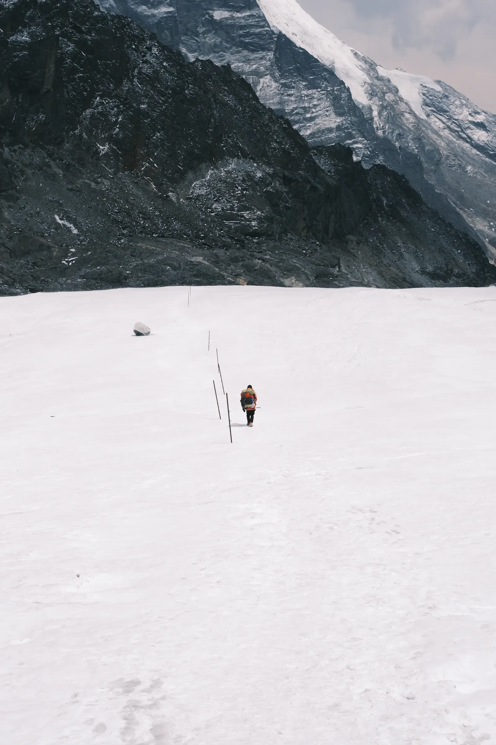
Today is one of the more demanding trekking days. The trail crosses Cho La Pass (approx. 5,420 m) before descending toward the Cholatse area. Snow and ice conditions can vary with the season and weather.
From there, the route continues to Cholatse Base Camp, marking the transition from trekking to the climbing phase of the expedition.
Altitude: approx. 5,000–5,100 m
After reaching Base Camp, attention turns to the climb ahead. The day is set aside for rest, acclimatization and technical preparation, and the climbing team checks personal and group equipment and goes over the route.
Depending on the team's experience and the final climbing plan, the guide may review:
- Crampon techniques
- Ice-axe use
- Fixed-rope movement
- Ascending and descending techniques
- Harness and carabiner systems
- Rope communication
- Climbing safety procedures
Today marks the start of the technical climbing phase. Depending on conditions, the team climbs above Base Camp toward the lower Southwest Ridge and Camp I (approx. 5,700 m).
This rotation helps climbers get familiar with the route and adjust to the higher altitude, and the team may also carry equipment and supplies to the higher camp.
After the acclimatization rotation, the team spends the day resting at Base Camp (approx. 5,000 m). This day is important for recovery and regaining energy.
The climbing team monitors everyone's condition, checks the latest weather and route updates, and inspects the equipment once more before the summit rotation begins.
The team leaves Base Camp and climbs to Camp I (approx. 5,700 m). The route becomes steeper as it approaches the Southwest Ridge, with snow, ice and mixed terrain depending on conditions.
Fixed ropes may be used on exposed or difficult sections when needed.
Altitude: approx. 6,000–6,100 m
The team continues higher along the Southwest Ridge, where the terrain becomes steeper and more technical. Climbers move carefully across snow, ice and mixed sections, using ropes and other safety equipment where needed.
The team monitors the weather and route conditions throughout the climb. The location and elevation of the upper camp may vary depending on route conditions and the expedition's climbing strategy.
Today is the expedition's main objective. The team begins the summit attempt early in the morning, depending on the weather and route conditions.
The climb continues along the Southwest Ridge over steep snow, ice and exposed terrain. Climbers keep a steady pace and follow the guide's instructions throughout the ascent, and the final ridge may be narrow and highly exposed, depending on current conditions.
After reaching the 6,423 m summit, the team spends limited time at the top before descending toward High Camp, Camp I or Base Camp, depending on the weather and the expedition plan.
Days 19 and 20 are kept flexible for the summit attempt. Mountain weather can change quickly, so the team may need to delay the climb if conditions are not safe. This time can also be used for further acclimatization or for reassessing the route.
How these days are used depends on:
- Weather
- Wind
- Snow and ice stability
- Route conditions
- Team health
- Acclimatization
- Fixed-rope conditions
- Overall mountain safety
The second flexible day for the summit attempt or recovery, used according to the weather, route conditions, team health and acclimatization.
After completing the climbing phase, the expedition begins its descent. The team leaves the high-altitude area around Cholatse and heads back toward the lower Khumbu.
Depending on the final route, the trail passes through Dzongla and continues to Pangboche (approx. 3,930 m). The lower altitude brings some relief after the demanding climbing days.
The trail continues through the Khumbu toward Namche Bazaar (approx. 3,440 m). You pass traditional Sherpa villages and forested areas as you descend, and the landscape becomes greener as the altitude decreases.
After reaching Namche, you can enjoy a relaxing evening after the demanding climbing days.
Today is the final day of trekking. The trail follows the Dudh Koshi Valley toward Lukla, crossing suspension bridges and passing through forested areas along the way.
After reaching Lukla, you can rest and prepare for your flight back to Kathmandu.
Today you fly from Lukla back to Kathmandu, depending on weather conditions and flight operations. After arriving, you transfer to your hotel and settle in.
The rest of the day is free to relax after the long trek and climb. You can also explore the city, enjoy a meal or prepare for your departure.
This day provides extra flexibility in case of flight delays or other unexpected changes.
If everything has gone according to plan, you can spend the day resting, exploring Kathmandu or doing some personal shopping. It is also a good opportunity to enjoy the city before leaving Nepal.
Your Cholatse Peak Climbing journey ends today. Depending on your flight schedule, you are transferred to Tribhuvan International Airport for your onward journey.
Before leaving, take time to look back on your experience in the Khumbu region, from the trekking trails and Sherpa villages to the challenges of the Cholatse climb. We hope you return home with wonderful memories of your Himalayan adventure.
Customize this trip
Every itinerary on this page can be changed. Tell us what you would like and a trip planner will send back a tailored day-by-day plan and price, usually within a few hours.
- Add rest or acclimatisation days
- Upgrade hotels and lodges
- Combine it with another trek, tour or safari
- Travel privately on your own dates
Dates & prices
Departure dates and prices are confirmed on request.
Can't see your date?
Pick any start date in the booking box or send us your plans and we'll confirm availability within a few hours.
Includes & Excludes
Includes
Transportation
- Airport pickup and drop-off
- Domestic flights according to the final itinerary
- Road transportation
Accommodation
- Hotel in Kathmandu
- Teahouse/lodge during the trek
- Tented camps during the climb
Meals
- Meals according to the itinerary
- Expedition meals during the climb
Guides and staff
- Experienced trekking guide
- Experienced climbing guide
- Porters
- Staff wages, meals and accommodation
Permits
- Cholatse climbing permit
- Sagarmatha National Park permit
- TIMS or applicable registration
- Local permits where applicable
Climbing support
- Base Camp support
- High-altitude camp support
- Group climbing equipment
- Fixed ropes and technical support where applicable
- Climbing briefing and technical guidance
Safety
- Basic first-aid support
- Emergency coordination
Excludes
Not included
- International flights
- Nepal visa
- Travel insurance
- Personal climbing equipment
- Personal trekking equipment
- Medical expenses
- Helicopter evacuation
- Extra accommodation
- Extra meals
- Alcoholic beverages
- Bottled drinks
- Wi-Fi
- Charging fees
- Laundry
- Personal expenses
- Tips
- Costs caused by weather delays
Packing list
Bring your personal climbing and trekking equipment; the company may provide the group equipment.
Personal climbing equipment
- Mountaineering boots
- Crampons
- Ice axe
- Climbing harness
- Jumar (ascender)
- Helmet
- Descender
- Slings
- Climbing gloves
- Insulated gloves
- Sunglasses
- Headlamp
- Technical clothing
Trekking equipment
- Trekking boots
- Trekking trousers
- Thermal layers
- Fleece
- Down jacket
- Waterproof jacket
- Waterproof trousers
- Warm socks
- Hat
- Gloves
- Sleeping bag
- Daypack
- Lip balm
- Sunscreen
- Trekking poles
- First-aid kit
- Personal toiletries
- Water bottles
Group equipment (may be provided by the company)
- Fixed ropes
- Climbing ropes
- Ice screws
- Snow stakes
- Group first-aid kit
- Communication equipment
- Kitchen and camping equipment
Useful trip information
Cholatse is a very difficult technical peak. Its difficulty comes from a combination of:
- High altitude
- Steep snow and ice
- Mixed climbing
- Exposed ridges
- Technical rope work
- A long summit day
- Changing weather
- Route-finding
- Cold temperatures
- Physical tiredness
Climbers should ideally have previous experience with:
- Crampons
- Ice axe
- Fixed ropes
- Ascending
- Descending
- Harness
- Carabiners
- Steep snow
- Ice climbing
- Rock climbing
- Mixed terrain
- High-altitude expeditions
Good physical preparation is important, so start training several months before the trip. Preparation includes:
- Long-distance hiking
- Uphill walking
- Stair climbing
- Running or other cardiovascular exercise
- Leg-strength exercise
- Core strength
- Carrying a loaded backpack
- Balance and stability training
Technical preparation is equally important. Climbers should have the opportunity to practise:
- Crampon movement
- Ice-axe arrest
- Fixed-rope ascending
- Rope management
- Movement on steep terrain
Cholatse should not be approached as a first-ever technical climbing experience.
Acclimatization is one of the most important parts of this journey. The route gains altitude through the Khumbu before heading toward the climbing area, and rest days and acclimatization hikes help the body adapt before the technical climbing begins.
At the higher camps, the expedition may also use climbing rotations, where climbers go to a higher altitude before returning to a lower camp to recover. This strategy helps prepare the body for the summit attempt.
The climbing leader determines the exact acclimatization strategy based on the team's condition and current mountain conditions.
Travelling above 3,000 m is challenging and exciting, but anyone can experience altitude-related sickness, regardless of physical fitness and previous experience. Symptoms include:
- Headache
- Nausea
- Dizziness
- Fatigue
- Loss of appetite
- Difficulty sleeping
- Shortness of breath
If you experience any of these symptoms, tell your guide immediately. If they worsen, they can become life-threatening and require immediate descent and medical treatment.
Never continue climbing just to reach the top if your health isn't supporting you.
Spring (March–May)
- A favorable period for climbing and trekking
- Temperatures and weather are generally at their best, though mountain weather depends on the route and conditions
- The weather still needs assessing, as mountain conditions are unpredictable
Autumn (September–November)
- Lower trails are drier
- Mountain views are clear
- One of the best seasons for a Himalayan journey
Winter
- Cold, freezing temperatures
- Strong winds and snow can make the trek harder
- Technical climbing becomes more demanding
Monsoon
- Rain, cloud and wet trails
- Route conditions need careful assessment
- Transport disruptions
Weather in the Himalayas can change quickly, and conditions at Base Camp can differ from those at the summit. Potential conditions include:
- Snowfall
- Poor visibility
- Changing weather
- Cold temperatures
- Rockfall
- Rocky terrain
- Cloud
- Wind, snow and icy terrain
The summit attempt therefore needs to remain flexible.
Safety is the most important thing on a Himalayan journey. The main risks include:
- Altitude sickness
- Rockfall
- Falling ice
- Steep snow
- Ice
- An exposed summit
- Strong winds
- Rapid changes in weather
- Technical climbing accidents
- Fatigue
Your guide assesses the route and conditions throughout the climb. If conditions become unsafe, the summit attempt may be delayed or cancelled.
Remember, a successful journey means returning safely, not simply reaching the summit.
Accommodation varies with altitude.
Kathmandu: hotel.
Trekking route: basic teahouses and lodges, where rooms and facilities are limited.
Climbing section: tented camps.
During the trek, teahouses and lodges provide meals. Common options include:
- Dal bhat
- Rice
- Noodles
- Pasta
- Soup
- Eggs
- Porridge
- Bread
- Tea and coffee
- Potatoes
- Momos
- Seasonal vegetables
During the climbing section, the expedition team prepares meals according to the package.
The journey requires valid climbing and trekking permits. These may include:
- Cholatse climbing permit
- Sagarmatha National Park entry permit
- TIMS or applicable registration
- Local permits where applicable
Check all permit requirements and fees against current regulations for your departure date.
Travel insurance is strongly recommended for Cholatse Peak Climbing. Your policy should specifically cover:
- High-altitude trekking
- Peak climbing
- Mountaineering
- Emergency medical treatment
- Helicopter evacuation where available
- Trip cancellation and interruption
- Flight delays
Climbers must stay flexible, as mountain weather cannot be guaranteed. Delays can be caused by:
- Flight cancellations
- Bad weather
- Snowfall
- Strong winds
- Route conditions
- Acclimatization requirements
- Illness
- Technical climbing conditions
The Cholatse route passes through the Khumbu, home to Sherpa communities with a strong Himalayan Buddhist culture. Climbers should respect the local communities and environment. Responsible practices include:
- Ask permission before photographing people
- Respect monasteries and other religious sites
- Follow local customs
- Avoid unnecessary noise
- Stay on the trails
- Minimize single-use plastics
- Carry a waste bag
- Use water responsibly
- Respect guides, porters and local staff
- Avoid damaging property or the mountain environment
Cholatse is a technical climb, so the trip can be customized around acclimatization and climbing preparation. The itinerary may be adjusted according to:
- Your available time
- Previous climbing experience
- Private or group departure
- Extra contingency days
- Transport preferences
- Accommodation preferences
- Extra Everest-region trekking
- Extra acclimatization peaks
Traveller reviews
Read more on TripadvisorPaced perfectly for the altitude
Our guide checked our oxygen levels every evening and never once rushed us. Standing at base camp after nine days of walking was emotional, and the team made it feel effortless to organise.
Thorong La at sunrise
We left High Camp at 4 am and topped out on the pass as the sun hit the snow. The teahouses were well chosen, food was hot, and our porter Binod became a friend.
Small group, big views
Mardi Himal was the perfect short trek for us. Rhododendrons in full bloom, Machhapuchhre right in front of us at high camp, and a guide who knew every village we passed.
Langtang exceeded every expectation
Close to Kathmandu but it feels remote. Kyanjin Gompa and the climb to Tserko Ri were highlights. Communication before the trip was quick and honest about what to expect.
Frequently asked questions
You might also like
More trips in the Everest Region and similar adventures.
Everest Region
Cho La Pass with Lobuche Peak-Cross High Mountains
Annapurna Region
Singu Chuli Peak Climbing
Annapurna Region
Chulu West Peak Climbing
Ready for the Cholatse Peak Climbing?
Send us your preferred dates. We'll confirm availability, flights and lodges, and answer any question before you pay a deposit.